Chapter 04 · Geographical analysis
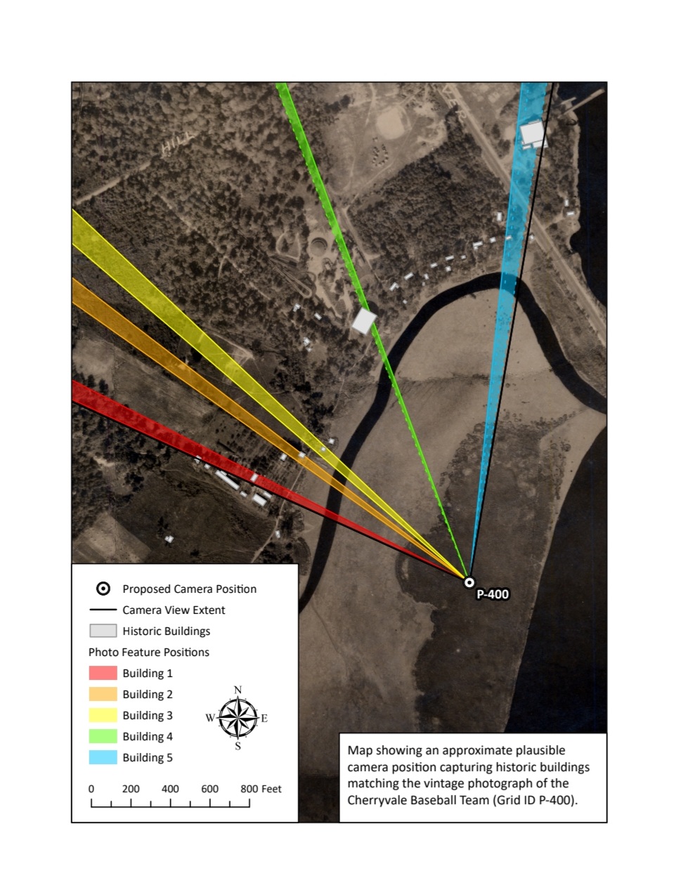
Five buildings. One plausible camera position.
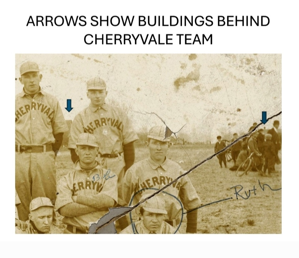
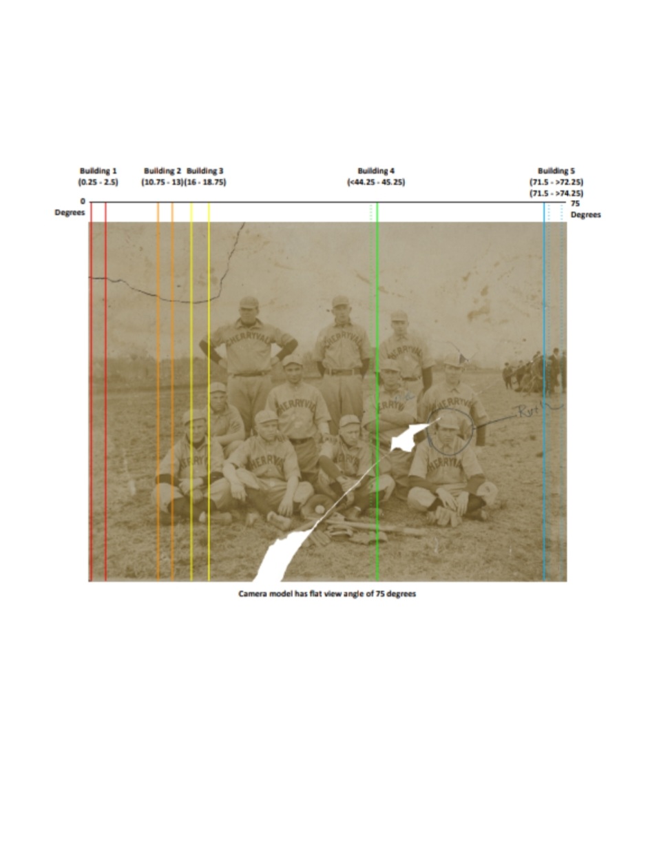
The location study compares structures in the background of the team photograph with historic aerial imagery and a modeled 75-degree field of view. Geographical analysis was conducted by registered GIS analyst and professional archaeologist, Erin King of the Resource Data Corporation.